
In the Texas Hill Country, there really isn’t any “bad road” to take! We take pride in the gorgeous scenery of our rolling hills and valleys, dotted with dozens of wonderful towns that all have unique stories to tell. In this article, we’re going to take a look at a loop of roads in the Hill Country that carries a somewhat eerie name: the Devil’s Backbone Road.
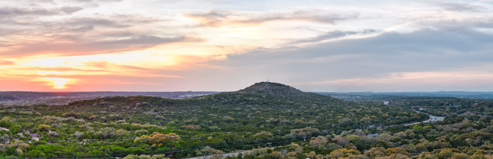
A long limestone ridge traces an erratic path between the towns of Blanco and Wimberley, which has been slowly eroded and exposed over the course of millions of years. When this geographic detail is seen from an elevated point of view, it creates the impression of the spine of some gigantic creature. Therefore, it was aptly named the Devil’s Backbone, with the roads surrounding it taking on the same moniker.
In the case of this particular loop, all roads lead to Blanco! They start there, too; to begin your 51-mile journey on the Devil’s Backbone Road all you need to do is plop yourself right in the heart of this charming town. Find your way to US Highway 281 and head south about three miles out of town; this leg of the journey will take you past Blanco State Park, which itself is a highly recommended scenic spot with plenty of opportunities for relaxation and recreation.
When US Highway 281 meets Farm Road (FM) 32, take a left. This stretch of road is known for its limestone hills and elevated views of the surrounding Hill Country. As a matter of fact, just north of the town of Canyon Lake there’s a designated sightseeing spot called the Devil’s Backbone Overlook, on the north side of FM 32. It’s a great spot to stretch your legs, take in some incredible views, and even have a picnic!
At this point, many travelers like to take a little detour southward on FM 484 that takes them to Canyon Lake. This is one of the deepest lakes in Texas, and offers water recreation like tubing, boating, swimming, and more along its 80+ miles of shoreline. While a fun and notable diversion, this stretch of road isn’t “officially” part of the Devil’s Backbone Road.
A few miles east of the Overlook, FM 32 ends, abutting FM 12; take a left turn here, heading northward. This section of the Devil’s Backbone Road will sweep you into the pretty town of Wimberley, which is another spot on the loop that’s fun to explore, with a museum, shops, and restaurants that cater to many interests and tastes.
At the intersection of FM 12 and FM 2325 in Wimberley, take a left, which will have you heading northwest. FM 2325 ends when it meets FM 165 a few miles west of Blanco; take a left here and you’ll make your way back to where you started! All told, the Devil’s Backbone Road is a roughly 51-mile loop; it’s easy to travel its entirety in one day, even with stops along the way.
Now that you have the navigational chops to visit the Devil’s Backbone Road, we invite you to check our articles archive for a deeper dive! We’ve devoted a second full article to the intriguing history of this area of the Hill Country. It’s an intense and sometimes bloody history, with otherworldly repercussions that many locals insist still echo through the hills and valleys here.
The roads of the Texas Hill Country, the Devil’s Backbone included, lead to dozens of historic and interesting towns, all of which feature businesses and attractions that appeal to all types of travelers. The Texas Hill Country Travel App features over 2,300 listings in 40 towns; it’s a powerful tool to assist you when you hit the road!